File:1861 Johnson Map of Mississippi, Louisiana ^ Arkansas - Geographicus - AKLAMI-j-62.jpg
Jump to navigation
Jump to search
Size of this preview: 427 × 599 pixels. Other resolutions: 171 × 240 pixels | 342 × 480 pixels | 547 × 768 pixels | 730 × 1,024 pixels | 1,460 × 2,048 pixels | 2,851 × 4,000 pixels.
Original file (2,851 × 4,000 pixels, file size: 3.49 MB, MIME type: image/jpeg)
Captions
Captions
Add a one-line explanation of what this file represents
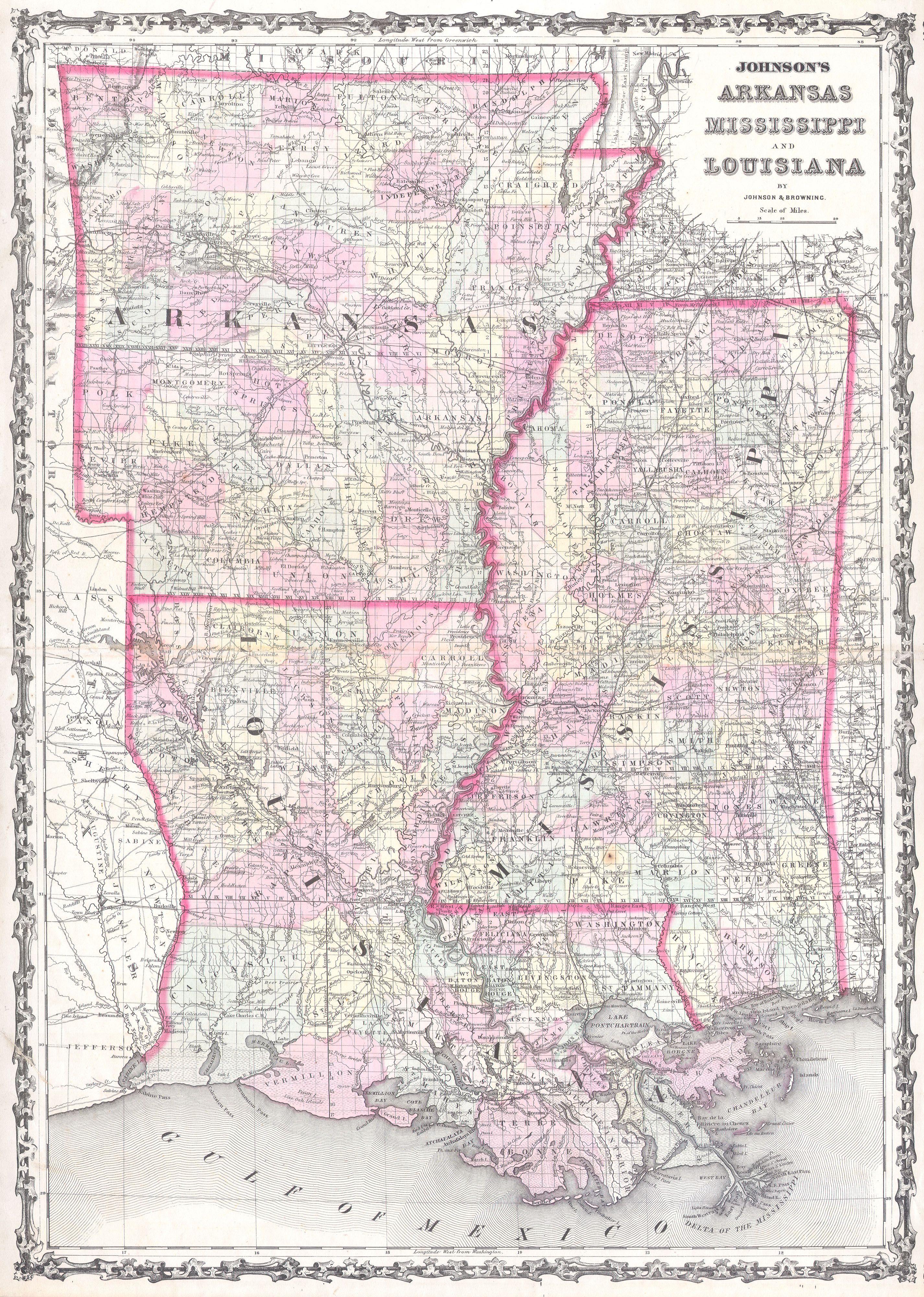
| Alvin Jewett Johnson: Johnson’s Arkansas Mississippi and Louisiana.
( |
|||||||||||||||||||||||
|---|---|---|---|---|---|---|---|---|---|---|---|---|---|---|---|---|---|---|---|---|---|---|---|
| Artist |
|
||||||||||||||||||||||
| Title |
Johnson’s Arkansas Mississippi and Louisiana. |
||||||||||||||||||||||
| Description |
English: This is Johnson and Browning’s 1861 map of Louisiana, Arkansas and Mississippi. Covers the states divided into counties with special attention to transportation, especially roads, railroads, and canals. Offers wonderful detail around New Orleans and the Mississippi Delta. Features the ribbon style border common to Johnson’s atlas work from 1860 to 1862. Steel plate engraving prepared by A. J. Johnson for publication as plates no. 37 and 38 in the 1861 edition of his New Illustrated Atlas… This is the last edition of the Johnson’s Atlas to bear the Johnson & Browning imprint. |
||||||||||||||||||||||
| Date | 1861 (undated) | ||||||||||||||||||||||
| Dimensions | height: 24.5 in (62.2 cm); width: 17.5 in (44.4 cm) | ||||||||||||||||||||||
| Accession number |
Geographicus link: AKLAMI-j-62 |
||||||||||||||||||||||
| Source/Photographer |
Johnson's New Illustrated (Steel Plate) Family Atlas, (1861 Johnson and Browning edition).
|
||||||||||||||||||||||
| Permission (Reusing this file) |
|
||||||||||||||||||||||
File history
Click on a date/time to view the file as it appeared at that time.
| Date/Time | Thumbnail | Dimensions | User | Comment | |
|---|---|---|---|---|---|
| current | 10:01, 16 March 2011 | | 2,851 × 4,000 (3.49 MB) | BotMultichill (talk | contribs) | {{subst:User:Multichill/Geographicus |link=http://www.geographicus.com/P/AntiqueMap/AKLAMI-j-62 |product_name=1861 Johnson Map of Mississippi, Louisiana & Arkansas |map_title=Johnson’s Arkansas Mississippi and Louisiana. |description=This is Johnson and |
You cannot overwrite this file.
File usage on Commons
The following page uses this file: